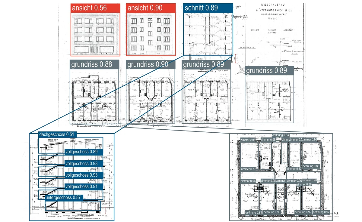
The aim of this AI service is to create semantic as-built documents (numbers and position of components in 2D plans) and to classify 2D plans according to their content. Furthermore, the service includes the recognition of floors in views and smaller elements in floor plans.
This use case deals with the automatic extraction of information from old scanned construction drawings using modern Convolutional Neural Networks. The information found is represented in GEOJSON format or other JSON-based formats, which makes it parsable and also compliant with the rest of the services. The GEOJSON stores information about the found objects and also their location. The semantic higher-level information about the as-built plan, such as (plan type and content) should be captured as part of the documentation and used in a separate use case.
Data
- Quality: The scanned plans do not have to be of very high quality. However, damage treatment may be required at the small object detection stage.
- Input data format:
- PNG
- JPEG
- Training data available:
- Permission is granted to use the data internally.
- Output data format:
- GEOJSON file incl.
- List of all detected bounding boxes
- Categorization of the bounding boxes according to the recognized class
- Names of the sections derived from the original image
- PNG : original images with bounding boxes
- GEOJSON file incl.
- Output data format as part of the Hochbau I demonstrator:
- PNG: a cropped image of the floor plan in question.
- Input and output data quantification as part of the Hochbau I Demonstrator:
- Takes a file as input
- Input and output data quantification as part of the Infrastructure 2 Demonstrator:
- Takes an image file as input
Contact Person:
Inri Staka, Schüßler-Plan